
This is Article 1 in an ongoing series examining America's abandoned and orphaned well problem.
I spent over 30 years as a geophysicist processing seismic data and building velocity models for petroleum projects across the Gulf of Mexico and international basins. Early in my career as a field engineer, I logged VSP surveys and cement bond logs, enough to understand what good wellbore data looks like and how rarely it exists for legacy wells. When I analyze wellbore failures like the Crane County blowout, I read the pressure signatures, excavation findings, and regulatory documentation the same way I evaluated data quality throughout my career. I'm looking for what's missing, what's inconsistent, and what the gaps mean for risk assessment.
Back then I was working with wells that had comprehensive construction data and active monitoring. Now I'm looking at wells where the only "data" is a paper filing from 1965 in a county courthouse basement, assuming it exists at all.
This is a technical narrative and source-backed synthesis, not journalism. I conducted no interviews. If you want verification for any claim, the sources are linked at the end. What follows is a subsurface and data perspective on what happens when plugged wells that should be sealed suddenly aren't.
CRANE COUNTY, Texas, January 2022
In early January 2022, a column of contaminated water erupted from the desert floor in West Texas and reached roughly 100 feet. It ran for close to two weeks. The volume estimate that shows up across public and technical discussions is on the order of 15 million gallons of produced water, a very high-salinity brine.
On paper, the well was plugged and abandoned. Then it started flowing.
The spectacle isn't what concerns me. What concerns me is what this implies about how many legacy wells are sitting in the Permian that are only sealed in the database and not in the field, and what happens once regional pressure conditions shift.
What the regulator said (dated, on the record)
At a Texas Railroad Commission (RRC) open meeting on January 25, 2022, the agency briefed the public on water chemistry and the still-uncertain mechanics. Clay Woodul, assistant director of field operations, said preliminary testing indicated a chloride concentration "almost to the point of saturation levels." The reporting on that update listed chloride around 174,000 ppm and sodium around 100,000 ppm, and stated that no hydrocarbons were detected in the water.
"We have not been able to identify the well, yet."
The same update showed how difficult the record-keeping problem gets when you're trying to pin down responsibility during an active event. The RRC initially identified the source as CT 112, a Gulf Oil well later acquired by Chevron. Excavation work turned up a different well about 10 feet away that matched CT 112's description, and the RRC said the blowout did not originate from CT 112. Woodul's quote was blunt: "We have not been able to identify the well, yet."
If you can't identify the well, you can't reliably identify the operator chain, and you can't reliably establish which plugging standard was applied. That's the situation regulators and landowners find themselves arguing over while the ground is still wet.
Antina Ranch: a specific well, with an API number
The Crane County geyser wasn't the only signal in that area.
A separate legacy-well failure on Antina Ranch shows up in court filings: Estes 24, API No. 42-103-00781. The petition describes uncontrolled brine flow discovered in June 2021 at a well alleged to have been plugged and abandoned in 1995.
That's the kind of detail I can actually work with. An API number you can look up beats a vague reference to an old well.
The human detail matters too, because it captures the operating reality. At an RRC open meeting in September 2021, ranch owner Ashley Williams Watt told commissioners, as reported: "Chevron hid the first two blowouts from me and refused to plug the Estes 24 until I complained loudly enough on Twitter." She added: "I'm pissed that this is my full-time job, figuring out their screw-ups."
What "failure" looks like (not always a geyser)
When casing is exposed, the inspection basics are straightforward. You look for salt staining or persistent wetness at collars and threaded connections, visible pitting or section loss, and any fresh corrosion products. Then you look for signs the well is still communicating: vent flow, bubbling at the casing and cement interface, and, if a gauge is on it, sustained annular pressure where you'd expect zero. If there's pressure at surface, you already have a barrier problem, regardless of what the filing cabinet says.
Plug failure isn't always dramatic. A lot of it is slow and unremarkable: corrosion, debonded cement, tiny pathways that become conduits once there's enough pressure differential. The mechanisms that operate in active well completions all operate identically in abandoned wells. Microannulus formation from cement shrinkage, casing corrosion from produced water exposure, and CO2 attack on cement bonds don't care whether a well is producing or plugged. The difference is that active wells get monitored. Plugged wells are assumed to be permanently sealed and receive no ongoing assessment.
One reason Antina Ranch draws attention is that wells were physically excavated and checked instead of being treated as fine because a plugging report exists in a database somewhere. The Texas Tribune reported that after excavations, at least 50 of 56 wells unearthed were leaking in some way.
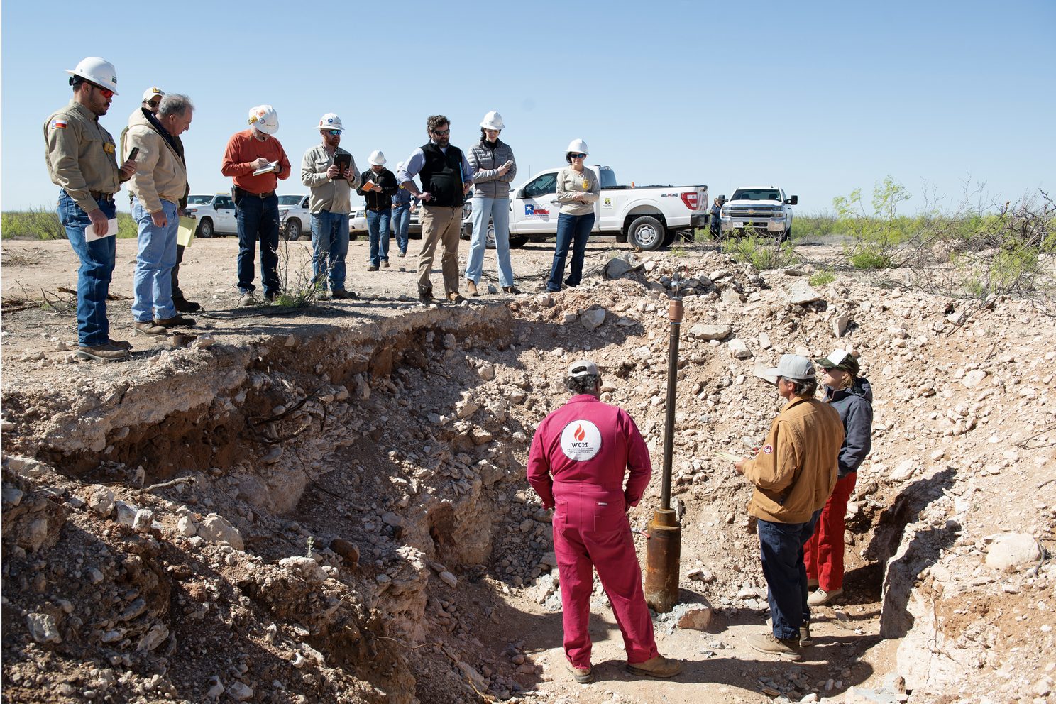
That number moves the story from an anecdote toward a pattern. It also highlights the data problem. How many other locations have similarly high failure rates that nobody knows about because the wells haven't been excavated? The data gaps make risk assessment nearly impossible without expensive field verification.
Pressure is the accelerant
From a subsurface standpoint, pressure is what drives these failures. If the pressure field changes regionally, for example with sustained disposal, you don't need to crack rock in any dramatic way. Put a degraded wellbore inside that pressure field and pressure will eventually find it.
This kind of analysis, integrating pressure modeling with deformation signals, requires subsurface training that most environmental data professionals lack. Building velocity models for petroleum exploration meant understanding how formation pressures, fluid migration, and structural deformation interact. That same analytical framework applies to abandoned well risk assessment. The harder part is getting the data infrastructure in place to actually perform these analyses at scale.
A useful, plain-English description of how this can look in InSAR comes from Pieter Bas Leezenberg (SkyGeo) in a LinkedIn post written about a year after the Crane County geyser. He compared a newer "Toyah" saltwater geyser to the 2021-2022 Crane County event and argued they look similar at the surface but differ in the deformation signal. In his description, Toyah had a quiet footprint with no obvious uplift or subsidence, consistent with a more local material failure. Crane County showed anomalous uplift consistent with a shallow high-pressure bulge being fed by a broader feeder channel, implying that injection influences miles away could matter for mitigation.
That LinkedIn post is not peer-reviewed. Think of it as an experienced InSAR practitioner explaining a diagnostic pattern, not a definitive adjudication of cause. Still, it captures the core intuition. If you can see uplift developing over a broad area, you should at least consider a regional pressure driver rather than a single bad plug.
For a peer-reviewed take on pressure changes, injection, and blowout timing, see the GRL paper in the sources list.
Money and law (where it gets messy)
Federal orphan-well funding exists, and it's real money. Texas RRC lists $25M as an initial grant in August 2022 and about $80M in formula grant allocation in January 2024.
Zombie failures don't always fit neatly into the orphan bucket, because the well may be closed in the records and tied to complex operator lineages. The rescue costs of well control, excavation, containment, and long-term remediation don't care about the paperwork category.
The fundamental problem isn't a lack of data. It's that the data exists in fragmented, inaccessible formats across multiple systems. The RRC maintains well construction records, production histories, ownership chains, and plugging reports, but extracting useful intelligence from these databases means navigating legacy systems, inconsistent formats, and incomplete records. When the RRC says it hasn't been able to identify the well during an active blowout, that's a data management failure. The well information exists somewhere. It just isn't accessible when it's needed.
This accessibility gap affects everyone: operators conducting due diligence on acquisitions, state agencies prioritizing remediation funds, surface owners discovering wells on their property, and environmental consultants assessing contamination risk. The technical knowledge exists. The regulatory data exists. What's missing is the connective infrastructure, the transparent and readily accessible platforms that integrate fragmented records into something usable.
On the legal side, the jurisdiction fight matters. Defendants argued the RRC had exclusive or primary jurisdiction. In an August 2023 public summary quoting the court, Watt's counsel (Daniel Charest and Sarah Stogner) cited the court's conclusion that the RRC's lack of exclusive and/or primary jurisdiction over Watt's common-law and statutory claims meant the district court had authority to issue injunctive relief and award damages as appropriate.
That doesn't decide the case. It does keep the courthouse door open.
Where I land (for now)
I don't think this is mysterious, and I also don't think it's one bad well. If you've got a dense population of legacy wells, aging materials, and a pressure field that's moving because the basin is being used hard, some plugs are going to get tested and some won't hold. The first sign might be a wet spot, or it might be a 100-foot geyser. That range of outcomes is the uncomfortable part.
If I were approaching this today as a screening problem rather than a courtroom problem, I'd start simple. Map legacy well density, layer in disposal and injection intensity, pull whatever surface deformation signal you can get your hands on even if it's imperfect, and then triage the oldest and least-documented wells first. That doesn't solve anything by itself, but it's a way to stop pretending the database equals the ground.
The part that makes this harder than it should be is records. When the RRC says it hasn't been able to identify the well yet, that's not a sentence you want to hear during an active incident.
I'm currently working on data management tools that address exactly this accessibility gap, taking existing RRC well location data, construction records, and regulatory filings and making them transparent and readily accessible to the people who need them: operators, agencies, surface owners, and consultants. The technical problem isn't exotic. Integrate fragmented databases, standardize inconsistent formats, build GIS-enabled visualization, and create APIs that let people actually use the data. The challenge is that nobody has done it systematically for abandoned and orphan wells, and the consequence is that we're managing a $30 billion liability problem with file cabinets and emergency response budgets.
My background processing petabyte-scale datasets in geophysics and building BI platforms for telecommunications and environmental analytics lines up directly with this problem. The skills I developed managing massive heterogeneous datasets, validating data quality across fragmented sources, and building platforms that translate technical complexity into something people can act on transfer directly to abandoned well data infrastructure.
Over the next several months, I'll be documenting what this problem actually looks like from both technical and regulatory perspectives, and exploring what data transparency solutions might work.
Next in this series: The terminology that shapes liability, why "abandoned," "orphaned," and "zombie" wells represent fundamentally different legal and financial categories, and why these distinctions matter for determining who pays for remediation.
Your Perspective
What's your experience with accessing abandoned well data? If you're working in environmental consulting, O&G operations, regulatory oversight, or land management, I'd particularly like to hear about:
-
Data accessibility challenges when trying to identify wells on a property or in an operating area
-
Gaps in publicly available well location and regulatory compliance information
-
Time and cost spent reconciling well records across multiple databases and systems
-
Use cases where better data transparency would enable better decision-making
-
Tools or approaches you've found effective for accessing fragmented well data
The conversation around abandoned wells has focused primarily on funding and regulatory reform. The data infrastructure challenge, how to make existing regulatory information readily accessible to the people who need it, receives less attention but determines whether remediation programs can prioritize effectively or whether we keep managing by crisis response.
Sources (key links)
-
RRC open-meeting update reporting (CBS7 / First Alert 7, Jan 28, 2022): https://www.firstalert7.com/2022/01/28/rrc-reports-heavy-contamination-crane-county-blowout-source-water-pressure-still-unknown/
-
Watt petition identifying Estes 24 (API 42-103-00781) (Scribd copy): https://www.scribd.com/document/653341645/2022-12-09-Watt-Watt-s-Original-Petition-and-App-for-Declaratory-Relief-and-Mandatory-Injunction
-
CBS7 "What Lies Beneath" reporting / Watt quotes: https://www.firstalert7.com/2022/01/21/what-lies-beneath-long-forgotten-wells-brine-water-health-west-texas-aquifers/
-
Texas Tribune reporting on leaking excavated wells (Mar 10, 2023): https://www.texastribune.org/2023/03/10/texas-permian-basin-fracking-wastewater-pollution-oil/
-
RRC federal orphan-well funding page: https://www.rrc.texas.gov/oil-and-gas/environmental-cleanup-programs/federally-funded-well-plugging/
-
Burns Charest summary quoting the jurisdiction ruling (Aug 21, 2023): https://burnscharest.com/headlines/2023/08/21/burns-charest-secures-summary-judgment-win-confirming-that-texas-trial-courts-not-the-railroad-commission-have-jurisdiction-to-adjudicate-claims-related-to-leaking-plugged-wells
-
Pieter Bas Leezenberg LinkedIn post (InSAR discussion; ~1 year after Crane): https://www.linkedin.com/posts/pbleezenberg_permianbasin-saltwaterdisposal-swd-activity-7255635778532261888-6dPD/
-
Karanam, Lu, & Kim (2024) GRL paper (DOI): https://doi.org/10.1029/2024GL109435
Method note: No interviews were conducted. Where sources emphasize uncertainty, such as pressure source attribution during the event, this write-up preserves that uncertainty rather than asserting conclusions.